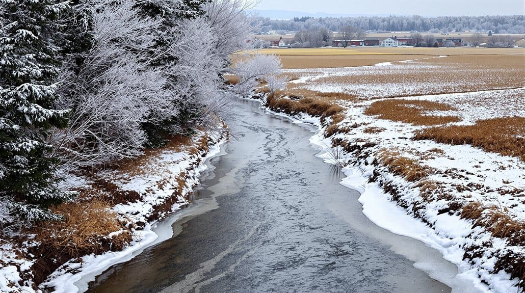
Winter flows in the Southeast depend on how much rain or snow you get, how warm winters are, and whether soils and shallow aquifers recharge; watch rain totals, snowpack or melt timing, and nearby well levels, and check stream gauges after storms. Look for steady baseflow, wet banks, ponding, and floating plants, carry a thermometer, oxygen meter, tape, waterproof boots and a logbook, test after big storms, and inspect ponds and staff gauges—keep going to learn specific tricks.
Some Key Points
- Winter baseflows often rise because lower evapotranspiration and cooler air retain more soil moisture and sustain streamflow.
- Snowpack and winter precipitation timing control recharge, with early melt or low winter precipitation reducing summer water availability.
- Floodplain ponds and wetlands store winter runoff, buffering peak flows and releasing water slowly during dry periods.
- Land cover and drainage (forests, agriculture, urban imperviousness) strongly determine winter flow volatility and recharge rates.
- Monitor winter rainfall, snow water equivalent, soil moisture, and well levels to anticipate low‑flow onset and seasonal shifts.
How Winter Rainfall and Temperature Set Low‑Flow Conditions in the Southeast
If you want to understand why streams run low in the Southeast when summer rolls around, start by watching what happens in winter, because that season really sets the table: below‑average winter rain or snow means less water soaks into soils and shallow aquifers, and with warmer winters you get faster snowmelt and more evaporation from soil and plants, so there’s less stored water to feed streams when hot, dry months arrive. You’ll want to watch winter rainfall totals and snowpack, note how early melts shift runoff, and check local well levels, because baseflows depend on recharge timing and aquifer depth; pack a simple stream gauge app or log, test after big storms, and compare upland versus lowland responses to judge where flows will hold out. Consider also how land use and riparian vegetation influence recharge and runoff, especially where shoreline vegetation has been altered.
Why Evapotranspiration Drops in Winter and What That Means for Water Levels
You’ll notice evapotranspiration falls in winter because plants drop leaves or go dormant so they stop transpiring, air gets cooler and holds less moisture which cuts evaporation, and calmer, cloudier days lower the atmosphere’s demand — together that means less water leaves soil and ponds. Watch for higher soil moisture and fuller wetlands or steady streamflow as a first sign, check for open water instead of green canopy loss, and if you’re monitoring gauges, compare winter ET estimates (often 30–50% of summer potential) to growing‑season values to see the change. If you want to act, start by measuring soil moisture and surface levels regularly through winter, note any snowpack that’s storing water, and plan for spring runoff timing rather than expecting quick losses to the air. Consider also maintaining biodegradable cleaners for gear after winter outings to protect waterways and sensitive wetland habitats.
Reduced Plant Transpiration
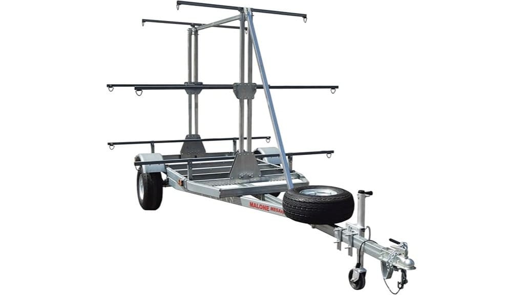
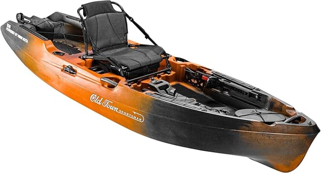
Watching plants go quiet in winter tells you a lot about why evapotranspiration falls and how water levels respond: deciduous trees drop leaves and evergreens partly close their stomata, temperatures and daylight shrink, and soil or snow can lock up water, so what was several millimeters of water loss per day in summer often falls to near zero, which means more water stays in the ground, feeds shallow groundwater, and raises baseflows in wetlands and floodplains. You’ll notice plant transpiration and seasonal characteristics by watching leaf cover, feeling soil moisture, and checking stream flow gauges, and you can act: monitor shaded soils, carry a small moisture probe, time walks after thaw, and record changes so you’ll link quiet plants to fuller creeks, then plan water use accordingly. Many paddlers also carry flotation gear and check kayak-ready equipment to be prepared for higher baseflows and winter conditions, including proper floatation bags for safety and gear protection.
Cooler Air, Less Evaporation
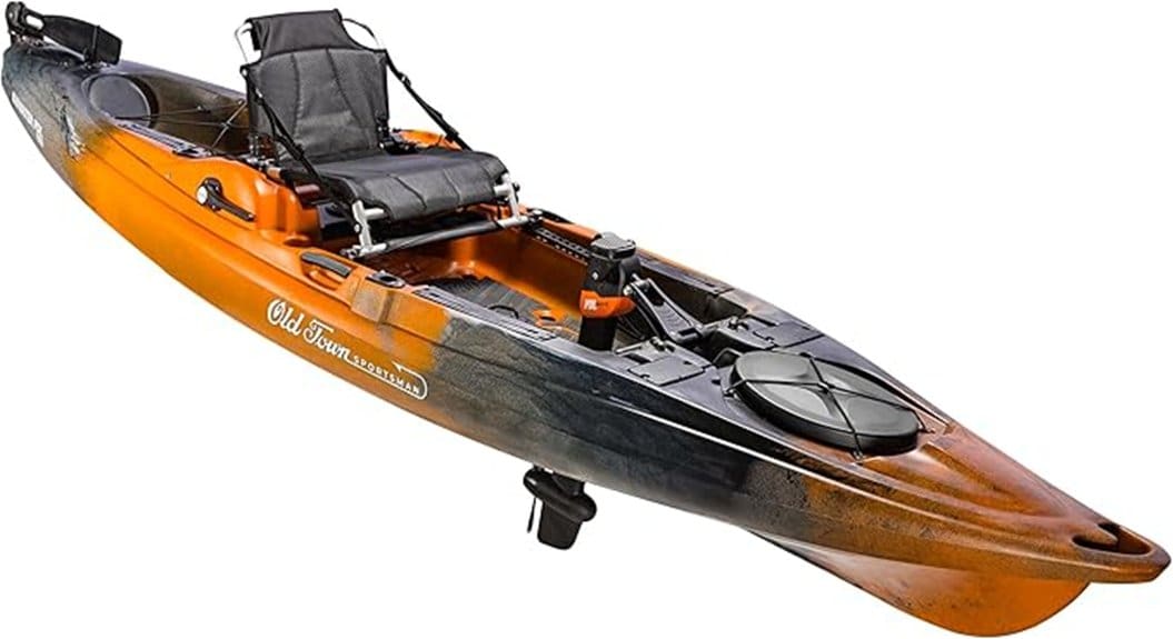
You’ve already noticed how plants quiet down and leave less water moving through leaves in winter, and that change is only part of the story because the air itself gets stingy with moisture and heat, which cuts evaporation from soils, puddles, and open water. You’ll see evapotranspiration drop, often 30%–50% lower than summer, because colder air holds less vapor and daylight fades, so net radiation that drives evaporation falls too. Water temperature cools, slowing vapor diffusion from surfaces, so puddles and shallow streams lose less water, and plant transpiration is minor. Watch for higher baseflow in creeks, carry a thermometer or simple gauge, note wetter banks, and expect fuller rivers—plan outings and water use with that seasonal gain in mind. Many paddlers also adjust gear and route choices based on kayak safety.
Soil Moisture Retention
Because colder air and frozen ground cut the energy plants and soil can use, you’ll see soils hold onto moisture in winter much more than in summer, so start looking for wetter banks, splashy puddles that last days instead of hours, and streams that keep a steadier baseflow even without recent rain. You’ll notice lower PET means soils lose far less moisture to the air, and when snowpack piles up it stores water as SWE until melt, so moisture sits under snow with roots and microbes mostly idle. Check stream edges, pack a simple soil probe or stick to test dampness, avoid compacting frozen ground, and plan outings around melt timing, because that delayed recharge controls when rivers rise. Also consider carrying a lightweight hypothermia kit and cold-water safety gear when paddling near winter flows, since colder water increases risk during outings.
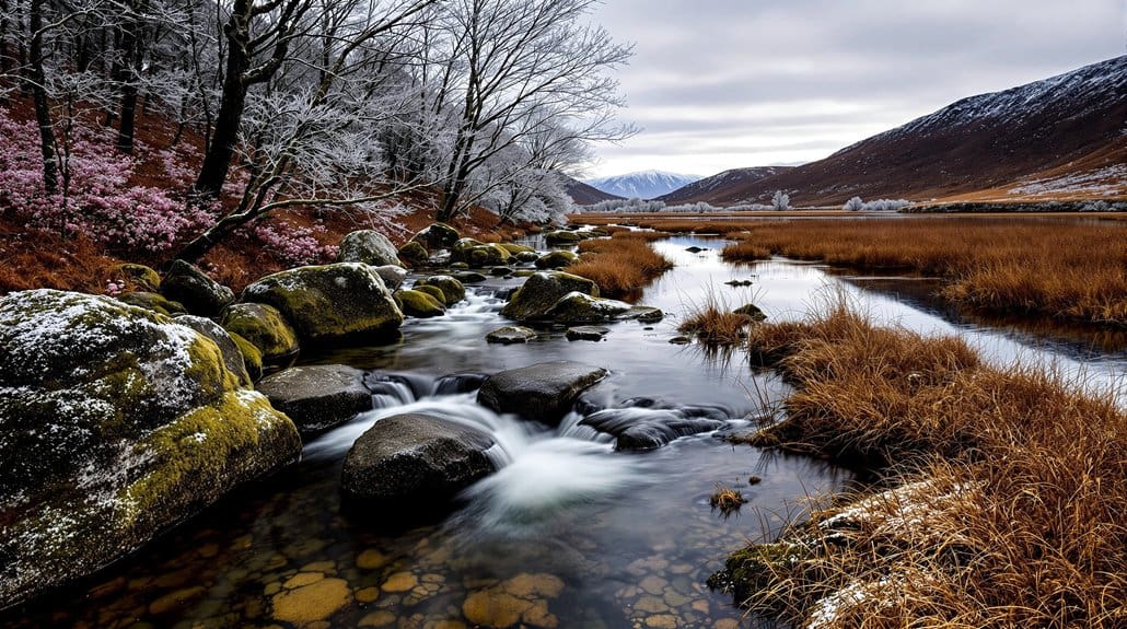
How Floodplain Storage Buffers Winter Flows and Moderates Downstream Peaks
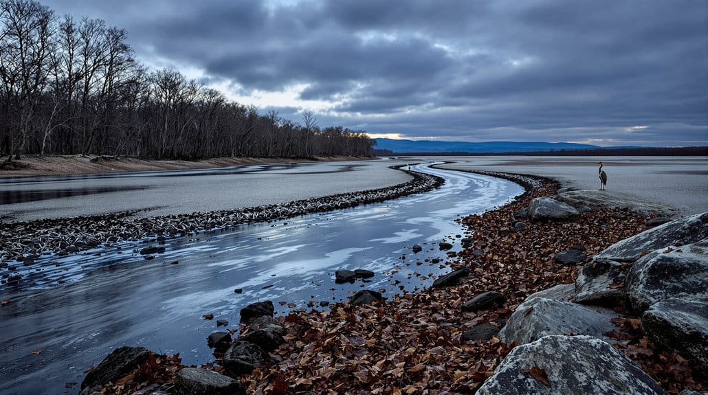
If you watch a stream after a storm, you’ll notice the rush doesn’t always make it straight downstream—floodplain ponds and shallow wetlands act like big, slow buckets that catch and hold water, and that’s exactly what’s going on in the Southeast during winter. You’ll see floodplain storage tamp down sharp peaks, water levels rise in nearby ponds and wells the same day a storm hits, and that delay means less intense floods downstream, so pay attention after heavy rain. Walk to a low spot, note pond depth and how fast it drops, carry a simple rod or phone to measure, and check a stream gage if you can; those quick observations tell you whether storage, wetland size, or prior wetness is doing the buffering work. For safe and enjoyable outings while observing these features, bring essential gear like a PFD, dry bag, and sturdy kayak bow floatation to stay prepared on the water.
How Short, Cool Storm Pulses Maintain Surface Water in Depressional Wetlands
Watch for quick, cool pulses after a fall or early-winter storm, because those short bursts can instantly top up small depressional wetlands and keep them wet when slower groundwater won’t—so bring a rod or tape, a notebook or phone, and check ponds and nearby wells the same day a storm peaks to see the jump in water level (we saw rises of about 0.3–0.4 m in events like Oct 2–6, 2015). You’ll notice short storm pulses drive near-synchronous spikes across ponds, even different sizes, and they’ll briefly link wetlands to the creek, moving sediment and nutrients while keeping surface water for amphibians and microbes, so measure peak and recession, note timing versus stream discharge, photograph staff gauges, and revisit to record the slower drawdown. Also consider carrying a compact staff gauge or level sensor to monitor short-term changes and aid safe recreation on waterways essential gear.
The Role of Groundwater Recharge in Sustaining Baseflow Through Cold Months
Watching how groundwater fills streams in cold months is one of the most useful things you can learn about local water, because it tells you whether small rains and snowmelt will matter later on, and what to watch for when you check a creek or well. You can watch groundwater recharge keep baseflow trickling when evapotranspiration drops and rains slip into the ground, note whether shallow aquifers feed steady winter discharge, and compare that to spring snowmelt timing if you live near mountains, because earlier melt can shift recharge and thin late‑winter support. Check wells, measure stream flow after storms, carry a simple tape and notebook, and flag sites where withdrawals or warming winters seem to lower recharge. Consider also carrying basic safety and signaling gear like an emergency beacon when you head out to monitor remote sites, especially on water.
How Land Cover (Forests, Agriculture, Urban) Changes Winter Runoff and Low Flows
When you walk a stream on a cool winter day, look first at the trees — a full forest canopy intercepts rain and snow, slows the water, and helps recharge the ground so low flows hang on, but when trees are gone and fields or roofs take their place the water runs faster and leaves the stream thirsty later in the season. Check the fields for tile drains or shiny drainage ditches and ask neighbors about no‑till or cover crops, because drained agricultural land and compacted soils speed water to channels and cut the slow, steady baseflow you want to see. And if you’re near a town, watch for lots of pavement, curb drains, and storm pipes that create big winter peaks and little late‑winter flow—start by mapping impervious patches, suggesting a few infiltration fixes like swales or rain gardens, and prioritizing riparian planting where you can to slow runoff and boost groundwater recharge.
Forest Canopy Interception
You’ll often notice that forests act like a slow sponge in winter, catching a lot of snow and rain on branches and leaves so less water runs straight off into streams, and that matters because it changes when and how much water shows up downstream; look for stands of mature deciduous trees, heavier branch cover, or evergreen patches that hold obvious buildup on limbs, because those sites typically cut throughfall by ten to thirty percent compared with open fields. You can watch interception storage—snow and rain held on twigs—sublime or evaporate, often losing twenty to forty percent before it ever hits the ground, so take note where canopy is intact, protect those patches, and expect steadier baseflow from places that let water soak in slowly rather than rush away.
Agricultural Drainage Effects
Think about where the land has been changed, and you’ll start to see why winter flows shift so much: walk the edge of a field that used to be forest or wetland and notice straight ditches, tiled lines, or a lack of leafy cover, because those signs mean water’s getting a fast exit route instead of soaking in slowly, so after a storm you’ll often see a quick spike in stream level and then a steep drop as groundwater isn’t recharged; if you want to spot this on a cold day, bring rubber boots and a simple staff to probe saturated ground, check for parallel lines in plowed fields that mark buried tile, look for downcut ditches on the downslope side, and compare nearby wooded strips or wetlands that hold water longer and feed steadier baseflow—all clues that guide where to prioritize small fixes like buffering with riparian trees, slowing drains, or restoring a floodplain to help store winter water and keep streams flowing through dry stretches.
Urban Impervious Runoff
Out in a neighborhood or along a suburban stream you’ll quickly notice how hard surfaces change winter water: roads, roofs, and parking lots send rain straight downhill as fast surface runoff instead of letting it soak in, so after a storm you’ll see a sharp spike in the creek and then a quick fall because groundwater wasn’t recharged; look for shiny pavement next to storm drains, gutters piped to concrete channels, or bare compacted yards that puddle then clear in hours, and bring a pair of boots, a simple topo map or phone app to check impervious cover, and a notebook to mark places where runoff hits a channel so you can prioritize fixes like adding rain gardens, permeable pavers, or tree plantings to slow and soak winter flows. Watch imperviousness thresholds—above about 10–15% your stream will flashier—and note stormwater drainage infrastructure that dumps flows to channels instead of soil, then start small: map hotspots, stagger plantings, push for curb cuts and bioswales to boost recharge and protect low flows.
Where Regional Climate and Topography Create Different Winter Flow Regimes
When you look across the Lublin region in winter, you'll notice that climate and land shape river behavior in very different ways, so start by checking whether a catchment sits in the lowlands or the uplands before you try to interpret any flow records. You'll want to think about the water cycle and water resources together, because upland catchments underlain by deep Cretaceous aquifers hold steady winter baseflow, they act like memory banks across 10–15 year cycles and buffer short storms, so check for sustained discharge. In lowlands with shallow Quaternary aquifers and lots of cropland, flows swing more with local drainage changes and surface runoff, so inspect maps for canals, reservoirs, and mining withdrawals, and treat gauges near Nielisz, Puchaczów, or Trawniki with caution.
How Winter Flow Patterns Affect Water Quality, Sediment, and Nutrient Retention
If you’re out checking rivers and wetlands in winter, notice that lower, steadier flows usually mean water and the bits it carries hang around longer, so start by looking for calm stretches, backwaters, and impoundments where silt and plant-rich muck are likely piling up. You’ll see that slower winter discharge traps fine sediments and particulate-bound nutrients, improving short-term retention but also meaning dissolved nutrient removal by plants and microbes drops off in colder water, so carry a turbidity tube or a simple secchi disk to gauge clarity, a notebook to mark depositional zones, and a thermometer to log temperatures; watch for brief storm-driven spikes that stir settled phosphorus and organic nitrogen, and note where steady groundwater-fed baseflows seem to moderate spring pulses downstream.
What Winter Flows Mean for Aquatic Life: Plants, Amphibians, and Fish Overwintering
When you walk shorelines in winter, notice where water stays deepest and where plants and leaf packs cluster, because those spots—deeper pools, inlet channels, or groundwater-fed pockets—are the refuges amphibians and fish use when surface wetlands shrink. Remember that cold water slows every creature’s metabolism, so you’ll see less movement and should look for subtle signs like clustered vegetation or benthic (bottom) activity, carry a simple thermometer and an oxygen meter or note cloudy ice and low flow as warning signs. If you find still, low-oxygen places, move slowly to avoid disturbing eggs and larvae, mark promising refuges for repeat checks after thaw pulses, and be ready to report sudden scouring or mass mortalities to local conservation groups.
Winter Habitat Use
You'll often find that winter water levels make or break where plants, amphibians, and fish can hang on through the cold months, so start by looking for wetlands that stay wet around half a meter deep—those persistent basins, with water about 0.5–0.6 m, keep floating plants like duckweed and water starwort alive, hold larvae and adult amphibians in moist refuge, and let fish and invertebrates move in after big October floods. When you scout seasonal wetlands, favor basins with standing stems and litter, note connections to creeks after storms, and expect winter inundation to be driven by precipitation and stream pulses, not groundwater; bring waterproof boots, a field notebook, a thermometer, and patience, record water depth and cover, and check again after floods.
Metabolic Stressors
You’ve already been watching which basins hold water into winter, and now start thinking about what that water — or lack of it — does to the animals and plants that have to live there; low, still winter flows can cut off oxygen and concentrate muck, so look not just for standing depth but for signs of sluggish water, surface scum, or odourless brown water that hints at high organic load. When you see lower winter streamflows, expect dissolved oxygen to fall, biochemical oxygen demand to rise as muck and leaf litter break down, and critters to slow down or suffocate, so carry a simple DO meter or checklist, note connectivity to deeper pools, watch for repeated hypoxic hits, and prioritize sites with groundwater influence.
How Managers and Paddlers Can Monitor Winter Low Flows and Anticipate Changes
Because winter low flows can creep up on you after a few dry weeks, start by checking nearby USGS or state gauge pages for real‑time flow and stage—many southeastern gauges update hourly and show the typical winter baselines so you can see if current discharge is well below historical medians. You should monitor recent and antecedent precipitation and, where relevant, SWE, using NWS products and local rain gauges to spot multi‑week declines, and watch 7‑day minimum flow and median winter discharge metrics to compare current trends. Track nearby groundwater readings if you can, and combine local minimum navigable discharge thresholds with short‑term forecasts, postponing trips when 7‑day flow is sliding toward unsafe levels, so you stay free to paddle smart.
Practical Actions to Protect Winter Wetland Inundation and Downstream Resilience
If you want winter wetlands to hold water and keep streams flowing, start by looking up and protecting the places where water actually moves and rests—check for old berms or pipes that block floodplain flow, see whether nearby beaver activity or shallow depressions can be left to pond, and note where riparian plants and trees are thin or absent so you can plan replanting. Walk sites to map blocked flows, carry a tape, camera, and flagging tape, and mark spots for small removals or flow-through culverts that restore water circulation, because reconnecting floodplains and adding off-line detention basins or beaver-like structures keeps winter inundation and baseflows. Monitor with simple loggers, limit winter pumping, and pick native sedges and trees for planting as management strategies.
Some Questions Answered
What Are Winters Like in the Southeast Region?
Winters in the Southeast are mild winters, with milder temps and high humidity, so you’ll feel cool damp days more than deep cold, and occasional frontal rains or brief freezes pop up, especially inland or in the mountains. Bring a water-resistant jacket, layers you can shed, sturdy boots for slick roads, and check forecasts before trips; watch for sudden rain or light snow, and expect streams fed by groundwater to stay steady.
What Season Has the Least Amount of Groundwater?
Late summer to early fall usually has the least groundwater, because high evapotranspiration and low rain cut recharge, and local factors like urban recharge or heavy agricultural pumping can make it worse. Watch well levels, soil moisture, and streamflow, carry a simple water-level meter or phone app, and reduce irrigation when you can; check municipal alerts, conserve water, and consider rain barrels or recharge-friendly landscaping to help bridge that dry window.
Is 2025 a Water Year?
Yes, 2025 is a water year, running Oct 1, 2024–Sep 30, 2025, so you’ll use that label for drought forecasting and reservoir management, and you should watch winter precipitation, USGS gages, and reservoir inflows closely, check soil moisture and streamflow percentiles, carry updated local bulletins, and act early to conserve or shift supplies, because early low winter recharge often means lower summer flows — want help finding the right gages?
What Are the Seasonal Fluctuations in Groundwater?
Groundwater falls in warm months and rises in cool, wet months, you’ll see aquifer recharge after heavy rains and deeper water when evapotranspiration rates climb, so check piezometers after storms, carry a simple water level meter, and log heads weekly to spot trends. Watch stream pulses for quick recharge, note upland versus lowland differences, and plan monitoring during summer droughts, you’ll learn how recharge timing affects wetland health.