In winter you’ll plan trips around tide tables and current charts, aiming for slack or a flood window near launch to avoid strong ebb through inlets, and you’ll check forecasts again a few hours before putting in; pack a drysuit or thick neoprene, spare paddle and tow, VHF/PLB, towline, emergency warming kit and quick‑access gear, file a float plan with ranger or buddy, pick sheltered creeks for exits, and set alerts for gusts—keep going for detailed timing, routes, and gear tips.
Some Key Takeaways
- Time trips around slack or an hour before/after high tide to ease creek mouths, beach crossings, and launch/landing depth issues.
- Check 24–48 hour NOAA tide predictions and recheck 2–4 hours pre-launch for shifts from rain, surge, or storm setup.
- Avoid peak ebb/flood in narrow channels and inlets; anticipate 1.5–3× speed-ups and plan alternate sheltered routes.
- Factor wind-tide interactions: opposing winds steepen waves; aligned winds can boost current speed 20–50%.
- File a float plan, mark multiple extraction points, and choose launches with close sheltered backwaters for emergency shelter.
Read the Tide Table and Pick Safe Launch/Return Windows
When you’re planning a cold-season paddle, start by actually reading the local tide table and matching it to your route, because tides and currents will decide whether a short trip turns into a long, tiring fight against the water; look up the exact high and low times from NOAA or your harbor office, note the predicted current peaks and the slack periods an hour or two before those peaks, and plan to launch at least 1–2 hours before a high or low tide so you avoid the strongest flows through inlets and narrow creeks. You’ll pick sensible launch/return windows, factor in tidal range and wind, add 30–60 minutes for short winter days, and file a float plan with specific tide heights so rescuers can find you. Also check your gear list and choose a kayak and equipment suited for cold-water conditions, including appropriate flotation and thermal protection, so you’re ready for winter paddling kayaks and gear.
Use Tidal Current Charts to Avoid Strong Winter Ebb Flows
Start by pulling local tide tables and the published tidal current charts for your route, looking for the predicted peak ebb times and the narrow inlets or creek mouths where charts show the strongest flow. Plan not to launch or arrive within about two hours of those peak ebbs, mark alternative routes or entry points that stay in sheltered water, and note slack windows (which often happen near local high or low water) so you can time crossings when currents are weakest. If northerly winds over 15–20 knots are forecast during an ebb, or charts show currents over about 3 knots in constrictions, change your plan or wait—bring a route map, a tide/current printout, and a clear float plan with expected slack windows. Also carry tide tables and current charts specific to your area and season to update timing and make safer decisions during winter outings, and consider consulting tide tables before heading out.
Read Local Tide Tables
Before you head out, pull the local tide tables for your exact launch and landing points—like the NOAA Charleston station (ID 8665530)—so you know the precise times and heights of high and low water during winter, because that timing tells you when slack is likely and when strong ebb flows can hit; check those numbers against tidal current charts or the U.S. Coast Pilot to spot risky windows. Read the tide tables, note high/low times, mark slack water windows near those times, and watch spring/neap cycles since winter full and new moons mean bigger ranges and stronger ebb flow. Combine predictions with on-water cues—rips, eddies, wind—and plan crossings for slack, carry a depth/speed gauge, and be ready to wait. Also outfit your trip with essential gear and waterproof marine charts to stay safe and confident on the water, including reliable waterproof charts for navigation.
Identify Peak Ebb Windows
If you check tidal current charts and tables closely, you’ll spot the two- to four-hour window on the falling tide where ebb usually peaks—often an hour or two after high water depending on underwater shape—so plan to avoid that stretch when you’re crossing exposed channels. You’ll use tides charts and NOAA current predictions, scanning for the two- to four-hour centered fall period, noting constrictions like inlets or bridges where ebb can speed up 30–100%, and comparing predicted ebb peak times with the wind forecast since winter winds can amplify or oppose flow. Aim to cross at slack or within ±30–60 minutes of predicted slack, carry an updated atlas or table, and be ready to delay if peak exceeds 2–3 knots. Also consider mounting a deck compass on your kayak for reliable bearings when visibility or electronics fail, such as a quality deck-mount compass.
Plan Alternative Routes
When you’re mapping out a cold-season coastal trip, treat tidal current charts like a route planner and a warning light at once: read the NOAA tables and regional pilot charts to find where ebb peaks—those narrow inlets and bridge constrictions can double or triple flow— and then pencil in alternate, more sheltered passages like inner creeks or backwaters so you’re not forced into a fast ebb, especially during spring tides when Charleston-area outlets can push 1.5–3.5 knots. Check predicted slack and plan crossings within ±30 minutes, aim for slack at Shem Creek or Kiawah River mouths, and mark inner Kiawah or St. Helena backwaters as detours if ebb tops ~2 knots. Pack a tow line, VHF, spare paddle, and note ferry or extraction points like Bulls Island. Bring a reliable handheld GPS and waterproof chart plots to track your position and timing, especially when visibility or daylight are limited and you need to navigate toward sheltered backwaters.
Choose Routes by Tidal Stage: Slack, Flood, or Ebb for Your Skill Level
Pick slack tide for stability when you’re newer to winter paddling, since the near-zero currents make creek mouths and narrow inlets easier to read and give you time to get your bearings and practice ferrying and re-entry. If you’re intermediate, plan to ride the flood to gain speed toward shore, but time your put-in so you don’t get slammed into a choke point, carry a compass and tow line, and watch for crosswinds that will multiply the current’s push. Only take routes that use ebb when you’re experienced, scout exits ahead of time because ebb can make fast rips and expose mudflats, and always check local tide and current charts for your launch and take-out times so you don’t get caught by a changing stage. Also bring appropriate rescue gear like a throw bag or pulley system for shore-assisted recoveries if conditions worsen, and learn how to use it safely (rescue pulleys).
Pick Slack For Stability
Slack tide gives you the calmest window, so aim to launch within about half an hour of that still period, which cuts down the effort you’ll need, the time you’re exposed to cold water, and the chance of getting pushed off course. You’ll want to think like Coastal Expeditions guides do: check NOAA tables for slack tide at nearby stations, pick Cape Romain or sheltered creeks, and plan a short crossing when currents are minimal. That lowers cold risk, keeps landings simple, and gives easy bail options. If you miss slack, choose routes with eddies or marsh channels, carry a tow line, wear dry layers, and know exit points, so you can still feel free while staying safe. Also consider a rudder-equipped kayak for better tracking and control in variable currents, especially when running narrow channels or making precise landings near marshes and inlets (rudder-equipped kayaks).
Ride The Flood Current
Standing on the shore, watch the water line and the charts, because riding a flood tide can turn a slog into a smooth push up an estuary, but it can also make your return tricky if you don’t time it—so plan to launch into the flood only when it’s easing you toward your intended creek or inlet, expect 1–3+ knots in narrow channels, and pick routes where eddies or marsh channels give you rest spots if the flow gets stronger. You’ll use tide/current info and local tables to pick a go window, aim to put-in/take-out near slack tide or where you can wait 30–60 minutes, carry a towline, GPS track, VHF or phone, and scout constrictions first. Check your gear list beforehand to include essentials like a reliable river level gauge and appropriate cold-weather safety equipment.
Plan For Strong Ebb
You’ve already thought about riding the flood and where to wait for a slack window, now flip that planning toward the outbound ebb: when the tide’s running out it can turn a comfortable day trip into a grind or worse if you get pinned in a narrow creek, so you’ll want to choose routes and timing that match your craft and skill. Expect ebb tides in the Lowcountry to hit 2–3+ knots in tidal creeks and inlets, so avoid narrow channels if your boat speed or skill is under 3 knots, plan starts or finishes around slack water on NOAA tables, favor downstream routes if you must go during ebb, pick sheltered marsh creeks for long winter outings, and always check tide and wind forecasts before launch.
Plan Trip Duration Around Daylight and Winter Tidal Shifts
Because daylight shrinks and tides still run strong in winter, plan your paddle so you launch after first light, finish at least an hour before dusk, and build in extra time for slow travel and tidal detours, like being pushed into an ebbing creek mouth; check the NOAA predictions and local tide stations (Shem Creek, Kiawah, Bulls Island), aim to hit slack or an hour before-to-after high tide for easier creek entries and beach crossings, and cut your summer mileage estimates by about 20–30%—so think 4–6 miles for a day trip instead of 6–9—while packing warm layers, a towline, spare paddle, headlamp, and a basic repair kit in case stops or route changes double your time on the water. Winter tides, daylight planning, tidal windows matter—read tide tables, plan conservative miles, and give yourself contingency hours.
Match Launch Sites to Expected Tidal Depth and Ramp Access
Now that you've built conservative daylight and tidal buffers into your plan, pick launch sites that match the water depth and ramp access you’ll actually get at the hour you intend to shove off. For tide planning, check MLLW and predicted ranges—Shem Creek’s 3–5 ft versus Kiawah’s 6+ ft—so you’ll favor launches near high-tide windows to avoid mudflats, and call rangers or ferries for barrier islands to time landings around +1.5 to +3.0 ft. Look at ramp slope and parking, arrive within ±2 hours of high tide where shallow concrete ramps need 1–2 ft of water, and choose sites with quick access to sheltered creeks to cut cold exposure. Use NOAA charts the morning of, ask about shoaling, and pack warm layers and a short carry.
Anticipate Wind + Tide Interactions That Amplify Currents
Pay attention to which way the wind is blowing against the tide, because onshore or opposing winds can steepen waves and opposing flows while winds that align with the tidal current will speed it up — picture a wind pushing water through a narrow inlet and suddenly you’ve got a fast, choppy run. Watch for channeling and funnel effects in creeks, passes, and between jetties where tides are focused, carry a VHF or cell with tide apps and recent station data, and time your launch or crossing to avoid peak ebb or flood windows when winds are forecast above 15–20 mph. If you’re unsure, pick a calmer window, stage your gear onshore, and ask local mariners or tide station observers for recent current reports before committing.
Wind Direction vs. Tide
When you’re planning a cold‑season coastal run, remember that wind direction and tide don’t just add together, they can multiply each other’s effects, so check both carefully before you leave: onshore winds against an ebbing tide will pile water and make steep, choppy waves and faster surface currents, a strong wind pushing with a flood tide can speed flows in channels by a fifth to a half, and crosswinds combined with a hard tidal flow will give you set and shear that tries to shove you sideways while the current drags you downstream. You’ll want to study wind‑tide interaction on charts and forecasts, avoid exposed crossings when opposing winds and currents align, time launches for weaker flow, pick lee spots near tidal creeks and inlets, carry a sea anchor or longer painter, and rehearse angled approaches so you stay free.
Channeling And Funnel Effects
Tuck this into your pre-trip scan: narrow channels and creek mouths act like funnels, so wind and tide can squeeze together and crank up currents to one-and-a-half to three times what you’d see in open water, making waves steeper, chop nastier, and eddy lines nastier near bends — have you checked where those pinch points are on your chart and whether a gale or a strong northerly is predicted during the ebb? You’ll want to mark funnel effects on your chart, check tide tables for slack water windows, and time passages 30–60 minutes around high or low tide, scout lee shores, and pick exits before committing, because opposing wind and tidal currents make headway slow or impossible, so carry a paddle leash, spare pump, and a plan to wait it out.
Timing Peak Current Windows
Look for the times when currents peak, and plan around them—on South Carolina inlets that’s often an hour or two before and after high or low tide, when flow can blast through tight channels at 2–4+ knots and make progress slow or impossible. You’ll check tide charts and real‑time gauges, note spring tides around new and full moons that boost tidal currents, and compare wind forecasts because aligned winds can add 20–50% to the push, so don’t go in blind. Aim for slack water or reduced flow windows to cross bars and narrow passes, carry a handheld VHF, extra fuel, and a reliable GPS track, and expect timing shifts after heavy rain or surges, so recheck predictions hours before you shove off.
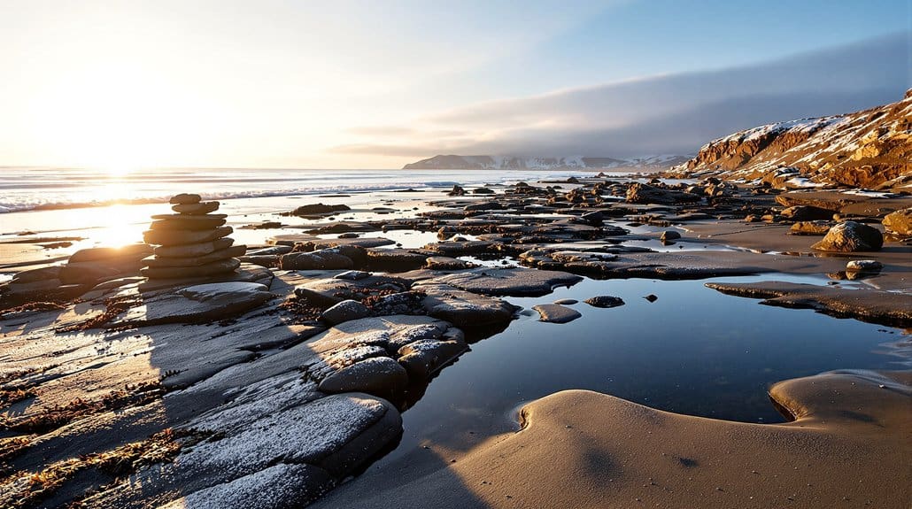
Scout Sheltered Creeks and Backwaters for Winter Low-Water Access
Along sheltered creeks and backwaters you’ll find the best winter low-water access if you know what to watch for, so start by picking spots like Shem Creek, the Kiawah River tributaries, or the blackwater channels of the Francis Marion and checking tide charts to plan launches an hour or two before high tide on an outgoing tide. You’ll want shallow-draft craft, a spare paddle, and GPS waypoints for creek mouths and sandbars, because winter exposes mudflats and new shallow cuts that hide oyster beds and stumps, so favor island-protected backwaters like St. Helena or Bulls Island to cut wind and see wildlife, and tap local knowledge at Francis Marion National Forest or Wambaw launches for maps and low-water launch tips before you go.
Adjust Paddle Plans for Clearer Winter Water and Submerged Hazards
Now that you've scoped the calmer creeks and backwaters for low-water launches, shift your plan to account for how much clearer winter water will change what you see and where you can safely paddle. With clear water you’ll suddenly spot submerged hazards like logs, oyster beds, and navigation markers from far off, so slow down near shallows, scan ahead, and pick lines that keep you well clear of shoals and oyster ridges. Check tide charts before you go, launch around safe windows, and re-scout channels at high tide since storms can move bars and shift routes. Wear a bright PFD, carry a paddle float and bilge pump, and when sightlines surprise you, back off, paddle a new line, or land to recon the channel.
Outfit Kayaks With Insulated, Quick-Access Emergency Gear
When you kit up for a cold-water paddle, think about putting lifesaving warmth and signaling tools within an arm’s reach so you can act fast if things go sideways, because seconds count and wet, cold hands don’t. Fit a small drybag or waterproof pocket between your coaming or on deck bungees with a foil emergency blanket, 1–2 hand warmers, and a sealed space blanket so heat retention is instant and compact, and keep a whistle, waterproof LED, folded map, and compact VHF or PLB in a quick-access pouch so you can signal and navigate without fumbling. Stow an insulated thermos with warm fluid in an accessible hatch, and carry a high-R-value bivy or down hood in a deck-mounted quick-release for swift shelter on expeditions.
Layer Clothing and Emergency Warming Systems for Cold-Water Exposure
You’ll want to think of your clothing and emergency warming gear as your first line of rescue, because getting heat back into a cold, wet body fast makes everything else possible, and that starts with what you wear and what you can reach in minutes. Wear a drysuit or thick neoprene wetsuit with a layered clothing system beneath—moisture-wicking base, warm fleece or down mid-layers, and a waterproof shell—change wet bases immediately to stop evaporative cooling. Pack an emergency warming kit in a sealed drybag with chemical hand/foot warmers, a foil bivy, a 4-season bag, R≥5 insulated pad, and a small stove to heat fluids, plus spare gloves and hat, redundant heaters, and a plan to get ashore within 30–60 minutes.
File Float Plans, Coordinate With Ranger Stations, and Check Wildlife Advisories
You’ve already planned your layers and emergency warming gear, and now you need to make sure someone ashore and the local rangers know where you’ll be and how to find you if things go sideways, so file a float plan that lists your route, put-in and take-out times, vessel type, everyone’s names, and an expected check-in time. Call the nearby ranger station before launch to confirm closures or local rules, give them your float plan details, and ask about recent wildlife advisories for bears, alligators, or nesting birds and turtles, then adjust route or timing to avoid active zones. Note your comms gear and battery states on the plan, include alternates and extraction points, and tell your contact how you’ll update them if plans change.
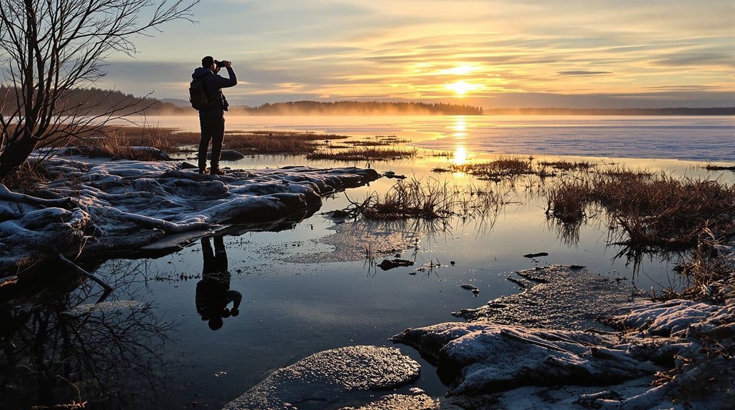
Monitor Live Tide/Weather Updates and Practice Rapid Re-Route Procedures
Even before you shove off, make a habit of watching live tides and weather so you’re not surprised out on the water—check NOAA tide predictions and your local station 24–48 hours ahead and again 2–4 hours before launch, then keep monitoring short-term marine forecasts and set alerts for things like gusts over 25 kt, sustained winds over 20 kt, cold fronts, or marine advisories that would force you to reroute. You’ll want a VHF and an app with AIS/tide overlays to spot commercial traffic, wind shifts, or tidal set, and rehearse two alternate exits with extra ETA time for headwinds or opposing currents, brief your crew on trigger conditions, assign navigation and comms roles, and practice a rapid re-route drill to execute in five to ten minutes.
Some Questions Answered
What's the Best Time of Year for Charleston Expeditions?
The best time is winter, December through February, when low season brings quieter creeks, clearer light and more migratory birds, but check the festival calendar and historic district events so you’re not surprised by crowds; aim for weekdays in January for solitude, pack layers, tide charts, and a headlamp, contact rangers, book guided trips early, and expect peak dolphin sightings late November–January around Shem Creek and Kiawah River for great photos.
What Wildlife Can You See on Charleston Expeditions?
You’ll spot shorebird migrations on barrier islands and flats, marsh mammals like otters and sometimes coyotes in creeks, and frequent dolphin encounters near Shem Creek and tidal channels, so bring binoculars, a waterproof jacket, dry bag, and a camera with zoom, paddle or hike quietly, watch low-tide flats for flocks and oyster beds, check tide charts and local advisories first, and stay patient, observant, and ready to move quietly for better views.
What Are the Benefits of Coastal Expeditions?
You gain clearer wildlife views, solitude, and hands-on learning, and you should start by checking gear maintenance, drying and greasing zippers, and testing paddles, then pack layers and a camera with spare batteries. You’ll build team building skills as you share navigation and safety duties, spot birds and dolphins, and swap stories, and you’ll get cultural immersion by visiting local docks, talking to guides, and timing tides for best sightings.