You’ll want a clear waterproof chart or topo, a baseplate (orienteering) compass and a handy deck/marine compass, plus a pencil and wristwatch, and keep electronics as backups, not sole guides. First orient your map to north, check local declination, then practice shooting bearings to three visible landmarks and plotting their lines to fix position, learning how to convert true-to-magnetic or set declination on the compass; follow a heading using ranges and frequent re‑checks for drift, and keep going to learn more.
Some Key Takeaways
- Orient your map to true north using known landmarks and adjust for local magnetic declination before plotting courses.
- Use a clear baseplate compass to take bearings: point arrow at the landmark, rotate bezel, then align needle with orienting arrow.
- Convert between map (true) and compass (magnetic) bearings by applying the local declination (add east, subtract west).
- Fix your position by shooting bearings to three identifiable landmarks and triangulating their intersecting lines on the chart.
- Build redundancy: carry paper charts, a baseplate and marine compass, preloaded GPS waypoints, and spare navigation tools.
Primary Search Intent and How This Guide Is Organized
Because good navigation starts with clear goals, this guide opens by telling you exactly what it’s for and how to use it, so you’ll know whether to read start-to-finish or jump straight to the parts you need; it focuses on the practical map-and-compass basics every paddler should master—orienting a map, taking and converting bearings, and following a heading on the water—then walks you through gear, chart choices, and pre-trip prep like updating declination and marking bearings, before teaching field steps you can repeat without second-guessing: orient the map, shoot a bearing to a landmark, correct for declination, and plot that line back on your chart for a position fix or triangulation, and it treats coastal techniques like dead reckoning, handrails/ranges, aiming off, and drift correction in their own section so you can pick the method that fits visibility, current, and sea state; throughout you’ll get clear, repeatable procedures and a constant reminder to build redundancy—carry both an orienteering baseplate and a marine/deck compass, keep paper charts as backups to electronics, add GPS waypoints before you launch, and practice triangulation and following headings in calm conditions until those steps feel automatic. You’ll also find advice on choosing top GPS gear and kayaks for navigating water trails with confidence, including when to rely on electronics versus paper and compass GPS gear.
Essential Navigation Tools Every Paddler Should Carry
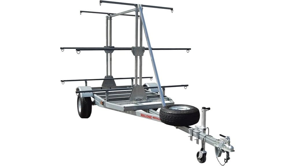
Think of your navigation kit as the one set of things you’ll always reach for when the sky goes gray, the phone battery dies, or the tide starts nudging you off course: carry a paper chart or topo map and a solid baseplate (or orienteering) compass for map work, plus a hands-free marine or deck compass you can lock to a heading while paddling, and make sure you’ve got a pencil and waterproof map case so you can mark fixes and keep your chart dry; note the local magnetic declination now and either set it on your baseplate or plan to add/subtract it mentally, clip or lanyard each compass so it won’t wander off, bring a small hand compass for quick triangulation, pack a length of string for securing tools or measuring short distances, and tuck a watch or stopwatch into an accessible pocket so you can time legs and estimate speed—then treat a GPS or phone as useful backup, not your only plan. For longer trips consider bringing spare gear and a basic repair kit, and learn how to use a marine GPS alongside traditional tools.
Paper Maps vs. Marine Charts: Which to Use and When
When you’re planning a paddle, pick the paper chart or topo map that actually matches where you’ll be floating—use marine charts for coastal and open-water trips because they show depths, tides, buoys and other aids you won’t find on a topo, and grab a topographic map for lakes, rivers and fuzzy shorelines since it shows contours, beaches, trails and likely landing spots; keep both in a waterproof case on deck so you can reach them at a glance, check and update the printed declination before you go (NOAA or local sources), and choose the right scale—large-scale marine charts (more detail, e.g., 1:40,000 or larger) for nearshore work, smaller-scale topos for planning broader routes—then pair a baseplate compass for reading map bearings with a deck-mounted marine compass for holding heading while paddling, clip or lanyard each tool so nothing drifts away, and treat GPS or phone as a backup, not your only plan.
Use marine charts when you need water depths and tidal currents, and topographic maps when shore features and access spots matter, always minding magnetic north versus true north and adjusting declination on your waterproof map before you launch.
Also carry a reliable chart plotter as a powered navigation aid to complement paper maps and compasses.
Compass Basics: Parts, How It Works, and Common Terms
Now that you’ve picked your map, it’s time to get comfortable with the compass itself—look for a clear baseplate with straight edges and rulers to transfer bearings to your chart, a rotating bezel (the 0°–360° ring) with an index line for setting exact headings, and the magnetized needle, orienting arrow and lines inside the housing that you’ll align to take accurate bearings. You’ll also want to check the direction-of-travel arrow and lubber (index) line on the baseplate so you know where to point the boat, and set the local magnetic declination on the compass or adjust your map readings so magnetic north and chart north match up. In the next bits we’ll walk through how to read and set a bearing, how to follow it on the water, and what to carry and practice before you push off so you’re confident if conditions or landmarks change. Consider investing in a well-reviewed marine compass as part of your kayak gear for reliable navigation on open water.
Compass Parts And Functions
Because a good compass is more than a needle, you’ll want to get familiar with each part and what it does before you head out on the water, so you don’t waste time guessing which mark or arrow to follow; start by holding the clear rectangular baseplate, notice the straight edge and ruler markings you’ll use to line up routes on your map and measure distances, then look at the rotating bezel (the azimuth ring) with degrees 0–360 and the index line where you set your bearing, find the magnetized needle (the red end points magnetic north) sitting over the orienting lines and orienting arrow that you’ll use to align the compass to the map’s grid, and finally check the direction-of-travel arrow on the baseplate that points where your bow should aim toward a chosen landmark or waypoint — and if your compass has a declination adjustment, either a little screw or a marking scale, learn how to set it so you correct the difference between magnetic north and true/map north for accurate map-to-compass conversions. A quality deck-mount compass can make steering and maintaining a course easier on longer paddles, especially when fitted to your kayak near the cockpit for quick reference deck-mount compass.
Declination And Bearings
If you want your compass to actually point you where the map says, you’ve got to understand declination and how it changes the bearing you read or plot, so start by checking the declination value for your area (it’s printed on most topo maps or you can look it up on NOAA), note whether it’s east or west of true north, and either set that correction on your compass’s declination screw or remember to add or subtract it every time you convert between map bearings (true) and what the needle shows (magnetic). Your baseplate compass has orienting lines to align with map north, so lay the edge between you and a target, rotate the bezel, read the bearing, then convert bearings if needed, or in the field point the direction-of-travel arrow at a landmark and align the needle to the orienting arrow to follow that magnetic bearing. Also make sure you have the essential gear, like a reliable kayak and waterproof marine charts, to support confident water adventures and accurate navigation with your map and compass essential gear.
Taking And Following Bearings
Get your compass out and hold it flat in your hand or on your kayak’s hatch, point the direction-of-travel arrow at the landmark or the course ahead, and rotate the bezel until the red needle sits inside the orienting arrow — that’s how you take a field bearing, and it tells you the magnetic heading you’ll follow. With a baseplate compass you’ll use the clear plate and orienting lines to line up targets, read the compass bearing at the index, and remember declination when translating map bearings to magnetic north, add or subtract the local value. To follow a bearing, set the bezel, point the direction-of-travel forward, turn the boat until the needle nests in the orienting arrow, then steer, correcting for wind or current. Consider mounting a deck-mount map case on your kayak to keep your compass and charts visible and dry while navigating.
Setting and Accounting for Magnetic Declination
When you’re planning a paddle, start by checking the magnetic declination for your area — that little angle between true north on the map and the compass needle — because it changes by place and slowly by time, and getting it wrong can send you off course. You’ll look up the declination value on your chart or NOAA, then decide how to adjust for declination before you launch, because in eastern North America you usually add declination to a map bearing to get a compass bearing, and you subtract when converting back. If your compass has a compass declination screw, set it once and read true bearings directly, if not, mark bearings as magnetic or write the correction on the map and double-check critical legs. For paddlers also consider bringing proper water navigation gear like a kayak compass and waterproof chart case to protect your tools and maps while underway; these essentials are part of good water navigation.
How to Orient Your Map Quickly on the Water
When you need to orient your map quickly on the water, lay it flat in a waterproof case with the top toward where you want to go and set your baseplate compass on it so the direction-of-travel arrow points up, then rotate the map until the needle sits inside the orienting arrow — simple, steady, and fast. If your compass has declination set, you’ll get bearings that match your chart, and if waves or wind make the needle jump, clip the compass to a deckline or use a small mirror sighting compass to keep it steady while you turn the map. Once the needle and map match, pick two or three clear landmarks you can see — a headland, island, tall chimney — and match them to the map to confirm your fix, and re-check every 10–20 minutes or after any course change.
Quick Compass Alignment
You’ll want to lay your map flat in its waterproof case, drop your baseplate compass on it with the direction-of-travel arrow pointing toward the top of the map, and then rotate the map — not the compass — until the magnetic needle slips inside the orienting arrow; that simple move gets your map aligned to magnetic north fast, so you can see at a glance which way islands, headlands, or channels actually lie relative to your boat. Set declination on your compass before you push off, then use a clear landmark to confirm, pointing the direction-of-travel at the feature, turning the bezel until the needle nests in the orienting arrow, and checking the map bearing matches what you see, holding gear steady in rough water.
Landmark Matching
Now that you’ve got your map matched to magnetic north, pick out three easy-to-see landmarks—things that stand apart from the shoreline, like a pointy headland, a church spire, or the tip of a small island—and find them on the chart, because matching those three gives you a quick, confident fix on both your position and how the map sits in front of you. Lay the map flat in a dry case, set your baseplate compass with the arrow to map top, then scan the shoreline for points, bays, buoys or docks that match map contours and confirm your spot. If visibility fades, take two bearings to known landmarks, correct for declination, plot them, and use triangulation to orient and move on with freedom.
Taking a Bearing From a Map and Converting to Magnetic
Grab your compass and lay its clear baseplate on the map so the direction-of-travel arrow points from where you are toward where you want to go, then line the straight edge up exactly between the two points and rotate the bezel until the orienting lines match the map’s north–south grid with the N marker aimed at map north; read the bearing at the index line — that’s your true bearing — and check the map’s printed declination (or look it up on a phone or chart) so you can convert to magnetic by adding or subtracting the declination for your area (for example, if declination is 12°E, magnetic = true + 12°); if your compass lets you set declination, put that value in once and it’ll save you from mental math, but if not, do the conversion deliberately, watching for values over 360° or under 0° and normalizing by subtracting or adding 360° (so 372° becomes 12°), then double-check in the field by pointing the travel arrow at a landmark, turning the bezel until the needle sits inside the orienting arrow, and confirming the compass reads your converted magnetic bearing before you commit to the route.
Taking a Bearing in the Field and Following a Heading
Start by taking the bearing you already plotted on your map, then hold your compass flat with the direction-of-travel arrow pointed at a clear landmark so you can rotate the bezel until the red end of the needle sits in the orienting arrow — that gives you the magnetic bearing at the index line. Before you push off, set a marine or deck compass near the cockpit with its lubber line aligned to the bow and turn the boat until the needle matches the lubber line, so you’ve actually translated the map bearing into a heading you can follow on the water. As you paddle, keep the compass level, check the needle and nearby landmarks often, and correct for wind or current by aiming slightly upwind or using two aligned range points, re-checking bearings if you feel yourself slipping off course.
Take A Map Bearing
When you’re ready to take a bearing, lay the map flat and put your baseplate so the straight edge connects where you are to where you want to go, then turn the bezel until the orienting lines line up with the map’s north–south grid — this gives you the map (true) bearing, which you’ll note at the index line; next check the map margin or NOAA for the local declination and add or subtract that number to convert to a magnetic heading you can follow in the field. After that, sight a landmark, point the direction-of-travel arrow toward it, hold the compass flat so the magnetic needle swings free, rotate the bezel until the red needle sits inside the orienting arrow and read the magnetic bearing, jot it down and remember reciprocal bearings for the return.
Hold Compass Level
Almost always hold the compass flat and level at chest height, with the direction-of-travel arrow pointing straight at the landmark you’re aiming for, because even a slight tilt or holding it near metal will make the needle wobble and give you a wrong bearing; keep it away from paddles, stoves, or other ferrous items, and if you’re in a kayak use a deck-mounted marine compass or a securely lashed baseplate near the centerline so you can point the boat and keep the needle inside the orienting arrow while you paddle. Hold the compass flat, rotate the bezel until the red end sits inside the orienting arrow, then read the bearing at the index line, set declination adjustment first if your compass has it, and watch for tilt-induced errors, keep compass away from metal so the needle aligns inside and you can move with confidence.
Maintain Your Heading
Pick a clear landmark, hold your baseplate compass flat with the direction-of-travel arrow pointed at that feature, and rotate the bezel until the red needle sits inside the orienting arrow so you can read the bearing at the index line—this simple field bearing is your steering cue. Before you push off, convert map bearings to magnetic by applying declination or set your compass so it reads true, then mount a marine compass near the cockpit with its arrow forward, turn the kayak until the orienting needle centers, and paddle keeping that needle aligned to hold your heading. Watch for drift from wind or current, use a range (two aligned features) or intermediate checkpoints to spot lateral shift, and re-check bearings every few minutes.
Fixing Your Position: Triangulation and Quick Fixes
You’ll want to nail down your position before you drift into uncertainty, so start by picking out two or three easy-to-see landmarks—like a lighthouse, a tall chimney, or a distinctive treeline—and take magnetic bearings to each from your boat by pointing the compass travel arrow at the feature, rotating the bezel until the needle sits in the orienting arrow, and reading the bearing at the index line; then convert those field bearings to map bearings with the local declination shown on your chart, because if you skip that step your lines on the map won’t cross where they should. On the map, set the baseplate on each landmark, align orienting lines with north, draw lines and find their intersection; use a third sight if you get a small triangle. For a quick fix, take reciprocal bearings between two landmarks to estimate where sight lines meet along your route.
Practical Paddling Techniques: Piloting, Aiming Off, Ranges, and Dead Reckoning
When you’re out on the water, start by picking a simple route and keep your eyes on the obvious handrails—shorelines, channel markers, a string of islands—so you can follow them and check your map without stopping every few minutes; you’ll use piloting to move confidently from one landmark to the next, aiming off when you want to be sure you’ll hit a recognizable shore feature, and using ranges (lining a near object with a distant one) to hold a steady course through wind or current. Watch ranges to spot drift, mark your fixes, then use dead reckoning between them, recording compass heading, speed and time to plot distance, adjust for drift compensation so your course over ground stays true, and enjoy the freedom of steady, simple navigation.
Six Field-Tested Tips for Using a Compass While Paddling
Now that you’ve got the basics of piloting, ranges, and dead reckoning under your belt, let’s get more practical about using a compass on the water, starting with what to bring and how to set up so you don’t fumble when conditions change. Bring a baseplate compass in a map case for plotting and triangulation, and a deck-mounted compass to keep hands free, set your deck compass to the magnetic bearing you converted from the true bearing using local declination, and trust the compass needle while you paddle. To take bearings, hold the baseplate flat, point at a landmark, rotate the bezel, read the magnetic number and convert if needed, use ranges to correct drift, and take two bearings for a quick fix.
Some Questions Answered
What Are the 4 D's of Navigation?
The 4 D’s of navigation are Decide, Direction, Distance, and Detect. You’ll Decide your route and route checkpoints, plan tide planning and weather routing, then set Direction using map-to-compass bearings while allowing for magnetic deviation to avoid bearing drift. You’ll measure Distance and use dead reckoning to track time and speed, then Detect your position with fix plotting and landmarks, even at night for night navigation, and correct course as needed.
How to Read a Compass and Map for Beginners?
You start by matching map symbols and landmark identification on the ground, lay the map flat, set declination adjustment so your compass reads true, then use sighting technique to point the direction-of-travel arrow at a landmark and read the bearing taking at the index. Watch for magnetic interference from metal, carry spare compass and practice pace counting for distance, care for compass by keeping it clean and out of extreme heat.
What Are Basic Navigation Skills?
Basic navigation skills help you plan and follow a safe route, using route planning, tide timing, and wind forecasting to pick when and where to go, while estimating currents and pacing distance so you don’t overshoot. Spot landmark spotting for fixes, carry a chart and compass with GPS backup, and practice night navigation basics like lights and bearings. Start by plotting bearings, checking tide/current charts, and rehearsing a short trip.
How to Orienteer With a Map and Compass?
You orient by matching map north to magnetic north, set declination, then pick landmarks, plot azimuths and use hand bearing navigation to confirm sights, pacing methods to measure distance, and triangulation techniques to fix position, while reading contour interpretation to understand slopes and water. Plan your route, identify clear landmarks, carry a declination-adjustable compass and spare map, and practice plotting bearings and pacing before you push off, you’ll feel confident.