You’ll get a dependable mid‑range chartplotter/fishfinder that pairs CHIRP traditional and ClearVü scanning for clear target separation and photo‑like structure imaging. The GT20‑TM transducer gives stable beams and solid depth penetration, while LakeVü g3 and BlueChart provide crisp contours and route previews with ETA. The 7" keyed display and tactile controls make on‑water operation quick, and Wi‑Fi sharing simplifies waypoint transfer. Keep going to see performance details, mapping tips, and comparable alternatives.
Some Key Takeaways
- 7" keyed display with high-contrast palettes offers intuitive, one-handed control and clear viewing in bright conditions.
- CHIRP traditional plus ClearVü scanning sonar (GT20‑TM) resolves individual targets and provides photo-like structure imaging.
- LakeVü g3 and BlueChart/Navionics maps enable detailed contours, route plotting with ETA, and waypoint sharing over Wi‑Fi.
- Multiple mount options (flush, tilt/swivel, quick‑release) and transom/trolling‑motor transducer compatibility suit small-to-mid boats.
- Best for budget-minded anglers wanting reliable mid-range sonar and mapping; consider Lowrance Hook2 or Humminbird Helix as alternatives.
Performance and Sonar Results: CHIRP Traditional + ClearVü Image Quality
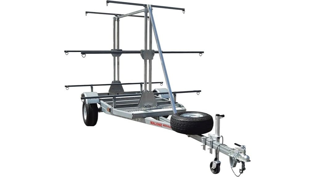
When you push power to the ECHOMAP UHD2 73CV, the CHIRP traditional and ClearVü work together to give clear, high-resolution returns that make target ID and structure reading straightforward. You’ll rely on precise sonar clarity from CHIRP to resolve individual fish echoes, while ClearVü sketches structure with photographic detail. The GT20-TM transducer delivers consistent beam stability and depth penetration. You interpret tight target separation even in schools, distinguishing lure-sized targets from cover. The keyed 7” display renders high-contrast palettes for rapid decisions. You get efficient, confident readings that let you roam and fish without compromise. Many kayak anglers pair these units with transducer arms to secure the GT20-TM and improve mounting flexibility.
Mapping and Navigation in Practice: LakeVü g3, BlueChart/Navionics, and Routing
Pull up LakeVü g3 and BlueChart/Navionics and you’ll see how the ECHOMAP UHD2 73CV turns chart data into actionable routing and waypointing. You’ll plot routes with precision, using detailed depth contours and crisp shorelines to avoid hazards. Route planning feels deliberate: snap waypoints to channels, optimize legs, and preview ETA and distance. Waypoint management is efficient—create, edit, group, and share via Wi‑Fi to other compatible units. Combined maps give inland and coastal confidence for free-roaming trips. Trust the integrated data to keep navigation proactive, minimizing surprises and letting you focus on the water ahead. For kayakers and new paddlers, pairing the unit with essential GPS gear improves positioning accuracy and on-water safety.
Display, Controls, and User Experience: 7 Keyed Screen, Palettes, and Menu Flow
Having mapped routes and waypoints with LakeVü g3 and BlueChart, you'll rely on the ECHOMAP UHD2 73CV's 7” keyed display and menu flow to execute them quickly and accurately. The physical keys give tactile confidence underway; button placement groups navigation, pages, and power for one‑handed use. Menus are hierarchical and fast — you dive to charts, sonar, or split views without hunting. Vivid color palettes are high contrast; color calibration out of the box is solid, with simple adjustments if you prefer punchier tones. Overall the interface is efficient, predictable, and built for operators who value control and open water freedom. It’s also a popular choice among paddlers looking for reliable navigation when paired with deck-mount compasses.
Connectivity, Transducer, and Accessories: GT20‑TM, Wi‑Fi Sharing, and Mounting Options
Several key connectivity and mounting choices shape how you'll deploy the ECHOMAP UHD2 73CV on the water. You get the GT20‑TM transducer included; install it using compatible mounting hardware for transom or trolling-motor setups, and follow transducer care guidelines to preserve signal clarity and prevent cavitation damage. Wi‑Fi lets you share waypoints, routes, and software updates between compatible Garmin plotters without tethering to a PC. Accessory options include flush, tilt/swivel, and quick-release mounts so you can reconfigure craft layouts fast. These choices give you operational freedom while keeping installation robust and serviceable. For kayak anglers and beginners, choosing a unit that balances portability and performance is key for successful trips, especially when considering portable fish finders.
Who Should Buy the ECHOMAP UHD2 73CV and Best Alternatives to Consider
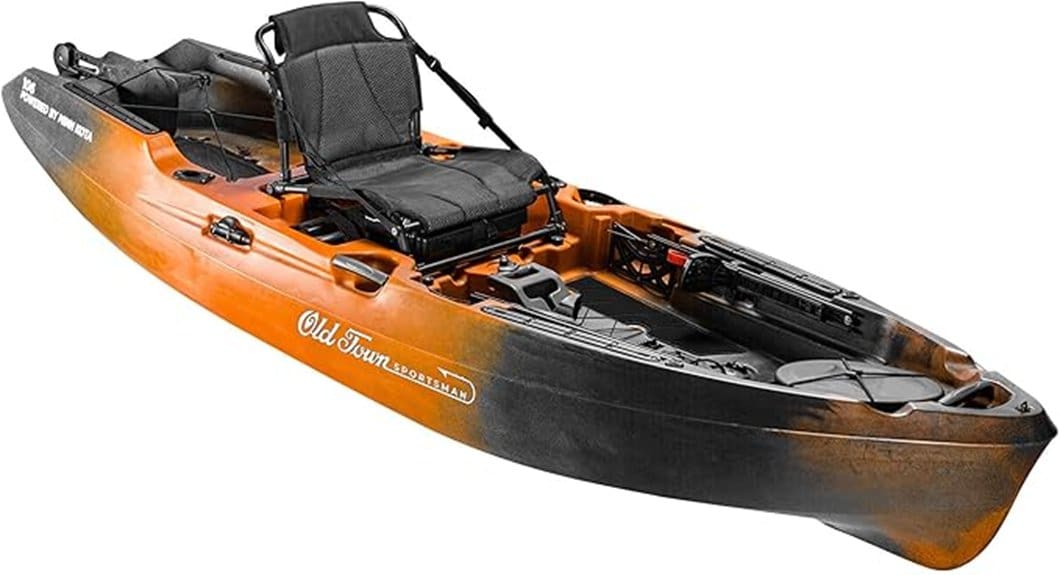
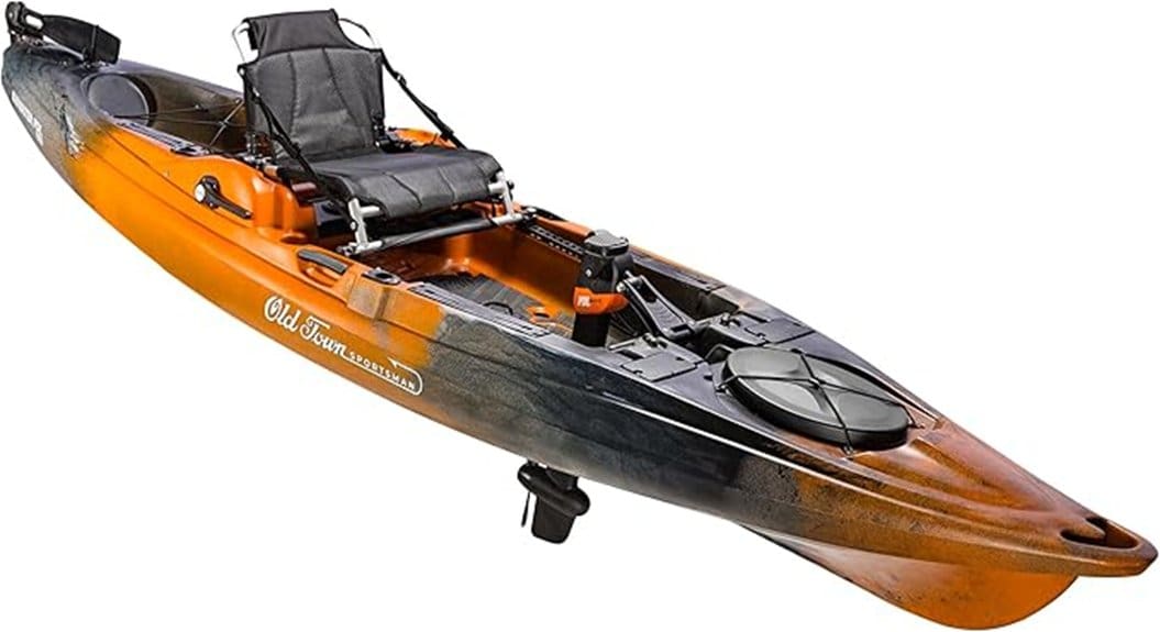
If you fish regularly from small to mid-size boats and want a reliable, mid‑range chartplotter/fishfinder that balances CHIRP traditional and ClearVü scanning sonar with solid mapping, the ECHOMAP UHD2 73CV is a strong fit; it gives you a bright 7" keyed display, included GT20‑TM transducer, LakeVü g3 and BlueChart/Navionics mapping, and Wi‑Fi sharing without the cost or complexity of higher‑end units. You’ll appreciate its straightforward interface, accurate sonar, and mapping for independent days on the water. It’s ideal for budget anglers and beginner boaters. Alternatives: Lowrance Hook2 series for simplicity, Humminbird Helix G3 for deeper imaging. Many kayakers and beginners pair fishfinders with specialized kayak mounts to keep displays secure and visible on the water.
Some Questions Answered
Does the Unit Support Garmin Autopilot Integration?
Yes — you can integrate it with Garmin autopilot systems. You’ll get autopilot compatibility when you connect a compatible heading sensor and use NMEA integration to share position and course data. That lets the chartplotter send course steering commands to an autopilot for reliable course steering and automated maneuvering. Set up’s technical but straightforward; you’ll feel free to trust the system once sensors and NMEA connections are verified and calibrated.
Can I Upgrade Internal Maps Later via microSD?
Yes — you can upgrade internal maps later via microSD expansion. You’ll add microSD cards to load LakeVü g3 or BlueChart updates, keep maps offline, and swap cards for route freedom. Note some advanced chart features may require an active map subscription to download updates or release premium layers. You’ll manage files through the keyed 7” interface or Garmin Express, and you can share cards between compatible units via Wi‑Fi or physical transfer.
Is the Display Glove-Friendly and Marine-Sun Readable?
Yes — you’ll find the display glove-friendly and marine-sun readable. The bright 7” keyed display balances sunlight legibility with durable control: physical keys work reliably with gloves, and the screen’s high-contrast vivid palettes maintain visibility in harsh sun. Touch responsiveness is present but supplemented by keys for precise input when conditions or gloves reduce accuracy. Overall, you’ll operate charts and sonar confidently in bright, wet marine environments.
What Is the Device's Waterproof Rating (Ip or Mil‑Std)?
Garmin doesn’t publish an IP or specific military standards waterproof rating for this unit, so you shouldn’t assume an official IP rating or MIL‑STD certification. You can expect marine‑grade sealing and splash resistance suited for open‑boat use, but Garmin specifies protection against water intrusion via design rather than listing IP/MIL ratings. If you need IP67/IP68 or MIL‑STD‑810G guarantees, you’ll want to verify with Garmin or choose gear that explicitly states those ratings.
Are Software Updates Downloadable Over Cellular Tethering?
Yes — you can download software updates using cellular tethering, but you’ll face cellular limitations like data caps and slower speeds. You’ll want to confirm tether security on your phone to avoid exposing the chartplotter during transfers. Use a trusted, encrypted hotspot, monitor data usage, and prefer Wi‑Fi when possible for large updates. That approach keeps you connected, minimizes risk, and preserves the device’s mapping and sonar performance.